Day Trip From Kyoto To Lake Biwa
Lake Biwa sits immediately east of Kyoto, close enough that a morning by the water and an evening back in the city fit into one ordinary day. This guide covers the rail connection from Kyoto Station, the areas around the southern shore, seasonal timing drawn from the Japan Meteorological Agency's Kyoto normals, and the transport fares and city taxes that shape the budget.
Short answer
Lake Biwa is Japan's largest freshwater lake and lies directly east of Kyoto across the mountains. The JR Biwako Line from Kyoto Station reaches Otsu, the lake's main city, in minutes, making it one of the shortest day trips out of Kyoto. Visit in spring or autumn for the best weather, and pair Otsu's waterfront with a temple or a lakeside walk.
Lake Biwa fills the basin east of Kyoto the way a reservoir fills a valley: completely. Japan's largest freshwater lake stretches north through Shiga Prefecture, and its southern tip, where the city of Otsu stands, sits just across the Higashiyama hills from Kyoto's eastern edge. The two cities have been neighbours for over a thousand years, and the rail line that connects them is short enough that Otsu behaves almost as an extension of Kyoto for day-trip purposes.
This guide lays out the practical side of the trip: what the JR connection from Kyoto Station actually involves, which parts of the shoreline reward a day visitor most, when to go based on the region's measured climate rather than folklore, and how the costs stack up. It also compares the lake against Kyoto's other day trips, because the honest question is rarely "is Lake Biwa worth it" but "is it worth it on this particular trip, against Nara or Ohara or Kurama". For a full menu of options, start with the day trips from Kyoto overview, and for everything inside the city itself, see things to do in Kyoto. This page is part of the wider coverage at Kyoto Travel Guide, where the transport, climate and fee numbers are all drawn from primary sources.
Why Visit Lake Biwa On A Kyoto Trip?
Lake Biwa gives Kyoto a large open waterfront that the city itself lacks entirely. Kyoto is built on a river plain hemmed by mountains, and its water experiences are the Kamo River and canal paths. Biwa offers an actual lake, with beaches, cycling routes, ferry rides and island shrines, all reachable from Kyoto Station on a regular commuter line, so the day costs little beyond the train fare and delivers a completely different landscape from temple Kyoto.
That contrast is the whole argument. A week in Kyoto is a week of gates, gravel gardens and wooden halls, magnificent ones, but the visual register is enclosed and vertical. The lake is the opposite: horizontal, open, wind-blown. On clear days the Hira Mountains on the lake's western shore read as a wall of snow in winter, and the water stretches far enough north that the far shore disappears into haze.
There is history here too, and it is not second-tier history. Otsu was briefly the capital of Japan in the seventh century before the court settled on Kyoto, and the city's temples and shrines include Enryaku-ji's rival institutions on the lake side of Mount Hiei. The Biwako Canal, dug in the late nineteenth century to carry lake water and boats into Kyoto, powered the city's first hydroelectric generation and still supplies water to Kyoto today. The lake is not a resort bolted onto a historic region; it is part of the same story as the city to its west.
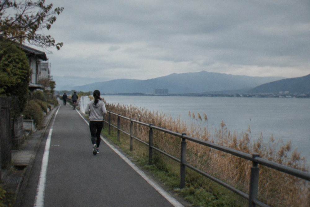
For planning purposes, treat the lake as several distinct day trips sharing one shoreline. The southern shore around Otsu is the short, easy option. The western shore, reached by the Kosei Line, is for beaches and quieter towns. The northern end around Nagahama and the castle at Hikone is a fuller day. A first-time visitor with one spare day should almost always take the southern shore, and this guide is weighted accordingly.
How Close Is Lake Biwa To Kyoto By JR From Kyoto Station?
The lake's southern shore at Otsu is the nearest major day-trip destination to Kyoto by rail: the JR Biwako Line runs direct from Kyoto Station toward Otsu and the Kosei Line hugs the western shore, with the first lakeside stations reached within a short suburban hop. The operator's own timetable and fare table give the current minutes and yen for each station, and no transfer is needed from Kyoto Station to the main Otsu stations.
The honest framing is that "Lake Biwa" is not one destination with one travel time. Otsu, on the southern shore, is the closest city of any size to Kyoto in any direction. Hikone, with its original castle, is a longer ride up the eastern shore. Nagahama, at the lake's northern end, is a genuine half-day of travel there and back. When a guide quotes a single "Kyoto to Lake Biwa" time, it is usually quoting the Otsu run, and the reader planning a Hikone day is being misled.
Practical notes that hold regardless of station. The JR lines run from Kyoto Station's own platforms, the same station the Kyoto Station area guide covers, so there is no cross-city transfer. Trains are frequent through the day because this is a commuter corridor, not a tourist line, which means you are not hostage to a morning departure window the way some rural day trips make you. And because the return leg is a suburban service, a late return from the lake is far easier than from, say, Koyasan, where the last connections matter enormously.
One warning worth printing in bold: check the fare and the route with the operator before you travel, and check it again on the day. This site's verified transport numbers cover Kyoto's city buses, the subway and the airport links in detail; the specific JR fare from Kyoto Station to each lakeside station is not a figure this site's research has read from the operator's own fare table, so it is deliberately not printed here. The Kyoto City transport figures that are verified are set out below, because most visitors combine the lake day with city travel on either side.
| Kyoto City transport | Adult fare | Child fare |
|---|---|---|
| City bus, flat fare | 230 yen | 120 yen |
| Subway, zone 1 | 220 yen | 110 yen |
| Subway, zone 2 | 260 yen | 130 yen |
| Subway, zone 3 | 290 yen | 150 yen |
| Subway, zone 4 | 330 yen | 170 yen |
| Subway, zone 5 | 360 yen | 180 yen |
| Subway and Bus One-Day Pass | 1,100 yen | 550 yen |
| Subway One-Day Pass | 800 yen | 400 yen |
If you are staying near a subway station and will ride the subway to Kyoto Station and back plus a bus or two, the Subway and Bus One-Day Pass at 1,100 yen often pays for itself on a day-trip day. Note what no longer exists: the bus-only one-day pass was withdrawn, with sales ending at the end of September 2023 and the last day of use 31 March 2024. Any guide still recommending it is at least two years stale. The ICOCA stored-value card, 2,000 yen including a 500 yen deposit, remains the simplest way to pay for both the city legs and the JR ride to the lake.
What Can You Actually Do Around Lake Biwa In One Day?
The realistic one-day visit splits into three shapes: a waterfront-and-temples day around Otsu on the southern shore, a beach day on the western shore reached by the Kosei Line, or a castle day at Hikone on the eastern shore. All three work as self-directed trips using regular trains, and the southern shore is the one that fits comfortably even into a half day, which makes it the default for travellers who do not want to sacrifice a full Kyoto day.
Around Otsu, the day writes itself. The lakefront promenade near the station is a straightforward walk, and the Biwako Canal, the nineteenth-century waterway that connects the lake to Kyoto, is both a pleasant path and a piece of engineering history. Temples and shrines in the Otsu hills include institutions with long histories in their own right, several of them connected to the same religious networks as Kyoto's famous temples. The lake's best-known island shrine, Chikubushima, sits in the northern basin and is reached by boat from towns on either shore; it is a genuine half-day commitment and suits a second visit rather than a first.
The western shore is the summer option. Sandy beaches line the Kosei Line towns, and the swimming season is a real season, with the lake shallow and warm by August. The cycling route that runs along the lake's shores is long enough that most riders do a section rather than the whole circuit; for Kyoto-based cycling generally, including bike hire options inside the city, see the Kyoto bike rental guide. The lake's scale is the point here: the route between shore towns feels like coastal riding, not canal-path riding.
Hikone, on the eastern shore, holds one of Japan's original castles, and unlike many castle towns the keep is authentic rather than a concrete reconstruction. The town is compact, the castle park sits on a rise above the lake, and the combination of castle, garden and lakeside makes a full but unhurried day. The trade-off is distance: this is the far end of the "one day" range, and it competes directly with other castle day trips such as Himeji Castle, which is a different direction and a different train line.
A comparison of the main shapes, in honest terms:
| Day shape | Best for | Effort | Fits a half day? |
|---|---|---|---|
| Otsu and the southern shore | Waterfront, canal history, temples | Low | Yes |
| Western shore beaches | Summer swimming, lakeside cycling | Low to medium | Yes, in summer |
| Hikone castle day | Original castle, garden, history | Medium | No |
| Chikubushima island shrine | Boat trip, island shrine | Medium to high | No |
| Northern lake towns | Slow travel, museums, quiet | High | No |
For families, the southern shore is the easiest sell: the waterfront is pushchair-friendly, the train ride is short, and the day can be cut short without waste. For travellers who have had their fill of temples, the beach and cycling options are the honest alternative, and they are the reason the lake earns its slot against closer green escapes like Ohara or Kurama and Kibune, which are both superb but both, again, enclosed mountain valleys rather than open water.
When Is The Best Time Of Year For A Lake Biwa Day Trip?
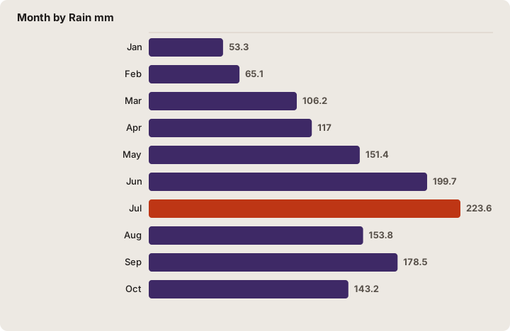
Spring and autumn are the strongest seasons for a lakeside day: the JMA 1991-2020 normals for Kyoto, the nearest long-record station, show April averaging 14.4 C and October 18.4 C with moderate rain, while July and August are the hottest and wettest months, with July the wettest of the year at 223.6 mm. Winter is cold but often clear, and the lake's far mountains with snow on them are a genuine sight.
The climate table matters more for a lake day than for a temple day, because a lake day is an outdoors day. Rain that shrinks a temple visit to an umbrella walk can end a beach plan entirely. The measured numbers for the Kyoto station, which sits just west of the lake across the hills, give the honest picture:
| Month | Rain mm | Mean C | Mean daily high C | Sunshine h |
|---|---|---|---|---|
| Jan | 53.3 | 4.8 | 9.1 | 123.5 |
| Feb | 65.1 | 5.4 | 10.0 | 122.2 |
| Mar | 106.2 | 8.8 | 14.1 | 155.4 |
| Apr | 117.0 | 14.4 | 20.1 | 177.3 |
| May | 151.4 | 19.5 | 25.1 | 182.4 |
| Jun | 199.7 | 23.3 | 28.1 | 133.1 |
| Jul | 223.6 | 27.3 | 32.0 | 142.7 |
| Aug | 153.8 | 28.5 | 33.7 | 182.7 |
| Sep | 178.5 | 24.4 | 29.2 | 142.7 |
| Oct | 143.2 | 18.4 | 23.4 | 156.0 |
| Nov | 73.9 | 12.5 | 17.3 | 140.7 |
| Dec | 57.3 | 7.2 | 11.6 | 134.4 |
Two corrections to received wisdom fall out of this table. First, July, not June, is the wettest month: 223.6 mm against June's 199.7 mm. The "rainy season ends in July" framing leads visitors to treat late July as safely dry, and the measured record says otherwise. Second, August is both the hottest month, a 28.5 C mean with a 33.7 C mean daily high, and the sunniest, at 182.7 hours. For a beach day that combination is fine; for a walking day it is punishing, and the record table adds a sharper note: three of Kyoto's six hottest days on record fell in the summers of 2024, 2025 and 2026, and July and August 2025 both ranked among the five hottest months ever measured at the station. Summer heat here is not folklore, it is a trend.
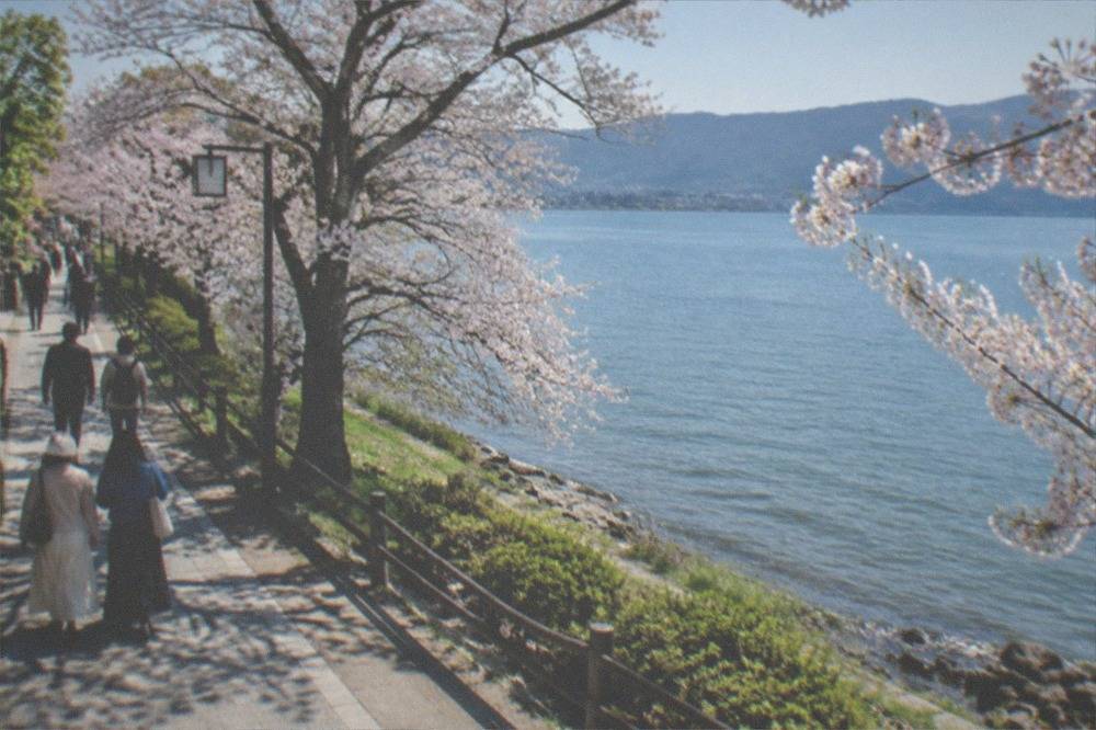
Spring timing can be pinned to measured dates. The JMA's Kyoto observatory records cherry flowering on 23 March 2026 against a 1991-2020 normal of 26 March, and full bloom on 30 March against a normal of 4 April; in 2025 flowering came on 27 March and full bloom on 5 April. The lake sits at essentially the same elevation as the Kyoto basin, so those dates transfer reasonably to the southern shore, with the caveat that the JMA dates describe the observatory's specimen tree, not any particular park. Late March into the first week of April is the window.
Autumn works the same way in reverse. The JMA normal for the maple's red leaves is 5 December, and the 2025 observation was 10 December, dates far later than the "mid-November peak" that most guides print. The honest phrasing is that the official marker is the observatory's own tree turning, and that the lakeside colour at eye level runs earlier than that marker, through late November. The ginkgo normal, 24 November, gives a second anchor. For the full picture, including the 2026 foliage forecasts for the Arashiyama side of the hills, see the Kyoto autumn leaves guide.
Winter deserves a word in its own favour. January is both the coldest month, a 4.8 C mean, and the driest, 53.3 mm, and the lake under a clear January sky with the Hira range snow-capped across the water is one of the region's under-used sights. The Kyoto in winter guide covers the city side of the same season.
How Much Does A Lake Biwa Day Trip Cost?
The core cost is the round-trip JR fare from Kyoto Station to your chosen lakeside station, plus whatever the day's activities add: temple and shrine admissions around Otsu typically run a few hundred yen each, a restaurant lunch in Otsu costs broadly what central Kyoto costs, and the city transport on either side runs 230 yen per bus ride or 220 to 360 yen by subway zone, with the 1,100 yen Subway and Bus One-Day Pass covering unlimited city travel for the day.
The transport side is where the verified numbers live, and they are set out in the table earlier in this guide. What the table cannot cover is the JR fare to the lake, because this site's research has not read that figure from the operator's own fare table, and an invented fare would be worse than none. What can be said with confidence is the structure: the fare is distance-based, the southern-shore stations are among the cheapest JR destinations from Kyoto, and an ICOCA card handles payment without any ticket-machine friction.
The accommodation side is worth knowing even for a day trip, because it affects where you sleep the night before and after. Kyoto's accommodation tax changed on 1 March 2026, and the top tier rose steeply:
| Room rate per person per night | Tax before 1 Mar 2026 | Tax from 1 Mar 2026 |
|---|---|---|
| Under 6,000 yen | 200 yen | 200 yen |
| 6,000 to under 20,000 yen | 400 yen | 400 yen |
| 20,000 to under 50,000 yen | 500 yen | 1,000 yen |
| 50,000 to under 100,000 yen | 1,000 yen | 4,000 yen |
| 100,000 yen and up | 1,000 yen | 10,000 yen |
The tax is charged on the room-only rate, excluding meals and consumption tax, and the city expects about 12.6 billion yen a year from the new tiers. A mid-range Kyoto hotel room in the 20,000 to 50,000 yen band now carries 1,000 yen per person per night rather than 500, and most competing guides still print the old tiers. The Kyoto trip cost guide works through the full budget picture.
For context on what the visit itself is competing against, Kyoto's own scale is worth knowing: the city's 2025 tourism survey, released by the city in June 2026, recorded a record 62.79 million visitors, of whom 12.68 million were foreign, and tourism spending of 2.0474 trillion yen. Those crowds are precisely the argument for the lake: the same survey reports day visitors at 46.20 million against 16.59 million overnight guests, meaning most of the pressure comes from people who never sleep in the city. A day spent east of the hills takes you out of that flow for the price of a train ticket. The Kyoto crowds guide covers the city's own dispersal measures, including the tourist express buses.
Lake Biwa Or Kyoto's Other Day Trips: Which One?
Choose Lake Biwa over Nara if you want water and open space rather than temples and deer; over Ohara or Kurama if you want a short, flat, weather-tolerant day rather than a mountain valley; over Himeji if you do not want the long ride. Nara remains the strongest single day trip from Kyoto for a first visit, and the lake is the strongest second choice for travellers whose Kyoto days are already temple-heavy.
The honest ranking depends on what your Kyoto week looks like. A first-time visitor with three days in the city should take Nara, full stop: the Nara day trip guide covers why, and the guided morning option listed below handles the logistics. A visitor on a fifth or sixth day, temple-fatigued, is the lake's natural customer. The beach and cycling options in particular have no real equivalent among Kyoto's other standard trips.
| Day trip | Main draw | Travel effort | Best for |
|---|---|---|---|
| Lake Biwa, southern shore | Waterfront, canal, open landscape | Low | Temple-fatigued visitors |
| Nara | Deer, great Buddha, park | Low to medium | First-time visitors |
| Ohara | Mountain village temples | Medium | Quiet seekers |
| Kurama and Kibune | Forest hike, river valley | Medium | Hikers |
| Amanohashidate and Ine | Sandbar, boat houses | High | Scenery hunters |
| Osaka | City, food, nightlife | Low | City people |
For the scenery-hungry, the honest comparison is with Amanohashidate and Ine on the Sea of Japan coast, which is one of Japan's three famous views but a long day. The lake gives you a version of that open-water feeling at a fraction of the travel. And for travellers weighing a Kansai base decision, the Kyoto vs Osaka guide covers the trade-offs, including the fact that the lake is reachable from Osaka as well, though with a longer ride.
One structural note in the lake's favour: because the JR line is a commuter corridor, the day is resilient. Miss a train and the next is minutes away; decide at 11:00 to go and you can still be on the waterfront before noon. Very few of Kyoto's day trips offer that, and it is the reason the southern shore works even for travellers who cannot commit to a plan the night before.
What Should You Bring And How Should You Plan The Day?
Bring sun protection and water in summer, when the mean daily high reaches 33.7 C in August and the lakeside offers little shade; layers in spring and autumn, when mornings start near 10 C and afternoons reach 20 C; and plan the day around the trains rather than the sights, because the southern shore is small enough to improvise but the northern destinations punish a late start. Luggage should not come with you at all.
The luggage point deserves emphasis. Kyoto's buses may refuse large or bulky items on crowded runs, and the city actively promotes hands-free tourism with station counters, delivery services and lockers to reduce bus congestion. A day trip with a suitcase in tow is a bad day trip anywhere, and on the lake it is worse, because the cycling and beach options assume you can move. The Kyoto luggage storage guide lists the verified options, including the hands-free delivery services the city itself promotes.
Timing the day: the strongest pattern for the southern shore is a mid-morning departure, the waterfront and canal walk before lunch, a temple or shrine in the early afternoon when the sun is at its highest, and the return to Kyoto by late afternoon, leaving the evening for the city. The pattern reverses in summer, when the lakefront is best before 10:00 and after 16:00 and the middle of the day belongs indoors. The city's own dispersal campaigns, which promote off-peak visits across time, season and location, are built on exactly this logic, and the lake is the easiest off-peak move a visitor can make.
Money and connectivity: the region runs on IC cards, and the ICOCA card at 2,000 yen including a 500 yen deposit covers the city buses, the subway and the JR ride east. Foreign arrivals through Kansai International should note the JR West HARUKA One-way Ticket for foreign visitors, 2,200 yen adult and 1,100 child to Kyoto, which is the verified visitor fare; the regular fare is single-source and this site prints only the visitor product. Travellers weighing connectivity on the move can check the eSIM for Kyoto guide.
Finally, the weather check. The Kyoto Tourism Comfort Forecast, run by the city's tourism association, predicts five-level crowd comfort for specific spots and time slots using location data and weather, and Fushimi Inari's own site links to it as a crowd tool. It is the best free answer to "which day this week" for any Kyoto-area outing, and a lake day planned against it beats one planned against a generic forecast.
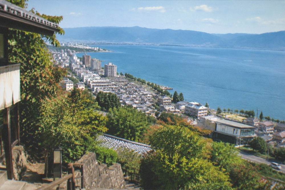
The lake rewards exactly the kind of traveller who has read this far: someone who wants the plan to hold up against real numbers rather than recycled folklore. The measured record says spring and autumn, the survey numbers say the crowds are day visitors you can step out of for the price of a ticket, and the commuter timetable says the whole thing is reversible at an hour's notice.
For travellers who prefer a curated day to a self-directed one, the guided options above cover the region's strongest itineraries, and the bus tour in particular suits visitors who want the logistics handled from a single meeting point. Whichever way the day is run, the lake itself asks nothing of you but a train ticket and a free afternoon.
Common Questions About A Lake Biwa Day Trip From Kyoto
How Close Is Lake Biwa To Kyoto By JR From Kyoto Station?
The southern shore at Otsu is one of the closest day-trip destinations to Kyoto by rail, reached direct from Kyoto Station on the JR Biwako Line with no transfer, within a short suburban hop. The exact minutes and fare vary by station, and the operator's own timetable and fare table are the authoritative source; the northern lake towns are a considerably longer ride and a fuller day.
Can You Swim In Lake Biwa?
Yes, the western shore has sandy swimming beaches served by the Kosei Line towns, with a genuine summer season when the water is warm. August is the hottest month in the measured record, a 28.5 C mean with a 33.7 C mean daily high, so the season is real but so is the heat; the beaches are best before 10:00 and after 16:00.
Is Lake Biwa Worth A Day From Kyoto?
For a first visit to the region, Nara is the stronger single day trip. For travellers with several Kyoto days behind them, the lake offers something the city and its temple valleys cannot: open water, beaches and long cycling routes on a short, frequent train ride. The southern shore around Otsu even fits a half day.
What Is The Best Time Of Year To Visit Lake Biwa?
Spring and autumn. The JMA 1991-2020 normals for the Kyoto station show April at a 14.4 C mean and October at 18.4 C with moderate rain. Cherry flowering in 2026 came on 23 March with full bloom on 30 March, and the maple red-leaf normal is 5 December. July is the wettest month of the year at 223.6 mm, wetter than June.
Do You Need A Guide For Lake Biwa?
No, the southern shore is an easy self-directed trip on regular trains, and English signage on the corridor is adequate. A guided tour makes sense if you prefer not to plan at all, or if you would rather spend your one guided day on a curated Kyoto or Nara itinerary and keep the lake as your independent day.
Can You Do Lake Biwa As A Half Day Trip?
Yes, the Otsu and southern-shore version works as a half day precisely because the rail link is short and frequent. The waterfront walk, the Biwako Canal path and one temple fit comfortably into a morning or afternoon. Hikone, Chikubushima island and the northern towns do not fit a half day.
A lake day is the simplest good decision a Kyoto itinerary can hold: low cost, low effort, weather-checked against a measured climate record, and a complete change of scenery from the city's gates and gravel. Pick the southern shore for a first visit, time it for late March or late November, carry an IC card, and let the commuter timetable do the planning for you.