How Is Kyoto Laid Out: Downtown, Higashiyama, Arashiyama, Fushimi, The North?
Kyoto is not one compact sightseeing core but five distinct zones, and the city's own 2025 survey counted a record 62.79 million visitors spread across them. Knowing which area holds what, and what each one costs to move around, is the difference between a trip that flows and one spent on buses.
Short answer
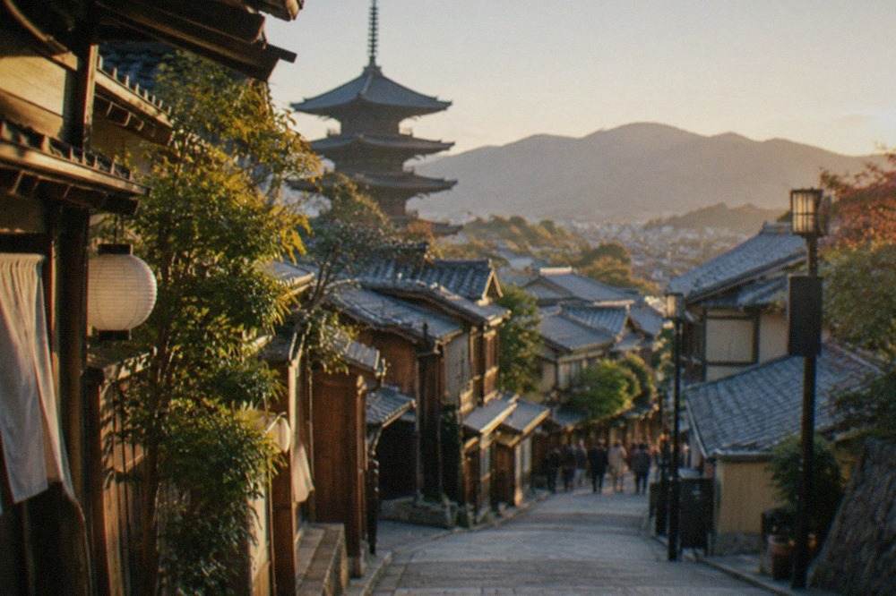
Kyoto splits into five workable zones: the downtown core around Kawaramachi and Kyoto Station, the temple-lined eastern hills of Higashiyama, the riverside west at Arashiyama, the sake country of Fushimi in the south, and the mountain north around Kurama and Ohara. Most first visits spend two days on the east and west, with Fushimi and the north as half or full-day additions.
How Is Kyoto Laid Out: Downtown, Higashiyama, Arashiyama, Fushimi, The North?
Kyoto sits in a basin, ringed by forested mountains on three sides, and the city grew along that geography rather than around a single plaza. The Kamo River cuts north to south down the east side, the old merchant and geisha districts face each other across it, and the famous temples climb the eastern and western hills. The city's 2025 tourism survey, released 12 June 2026, counted a record 62.79 million visitors across the year, 46.20 million of them day visitors, which is precisely why the layout matters: the crowds thin out fast once you cross a river or ride two stops past the guidebook core. This page walks each zone in the order most trips meet them.
What Does Central Kyoto Look Like: Downtown And Kyoto Station?
Central Kyoto is a flat, walkable grid made of two cores: the downtown shopping belt running from Karasuma through Kawaramachi to the Kamo River, and the Kyoto Station transport hub a ten-minute subway ride south of it. Between them sit Nishiki Market, the museum quarter and the bulk of the city's hotels. The subway fare from Kyoto Station to the downtown core runs 220 to 360 yen depending on zone, and the flat city bus fare is 230 yen, so the centre is cheap to cross but slow by bus at peak times.
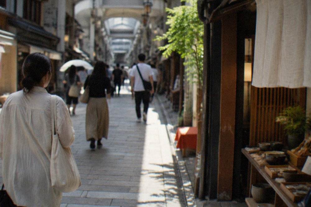
Downtown is where Kyoto behaves like a modern Japanese city. Teramachi and Shinkyogoku arcades run north from Shijo-dori, department stores cluster at Karasuma, and Pontocho Alley threads a narrow lantern-lit lane between Kawaramachi and the river. Nishiki Market sits one block north of Shijo, and the market association prints no unified hours: individual shops keep their own, roughly from 9 or 10:00 to 17 or 18:00, and the market's own rule asks visitors not to eat while walking. The covered market is the best single stop for the city's food culture in the centre, covered in full on the Kyoto food guide elsewhere on this site.
Kyoto Station itself deserves a paragraph, because many visitors underestimate it. The station building holds a department store, a ramen floor, a theatre and the Haruka airport express, and the surrounding Kyoto Station area is one of the city's most practical places to stay. The JR West visitor one-way Haruka ticket from Kansai Airport costs 2,200 yen, and the limousine bus from Itami Airport is 1,500 yen with a journey of about 50 to 55 minutes, so the southern end of downtown is where most trips physically begin.
| Central Kyoto zone | What it is | Anchor sights |
|---|---|---|
| Karasuma to Kawaramachi | The main shopping and dining belt | Teramachi arcade, Pontocho Alley, Nishiki Market |
| Kyoto Station area | Transport hub and hotel district | Station building, Kyoto Tower, Higashi Hongan-ji |
| Kamo River banks | Riverside walking and dining strip | Pontocho terraces, river path to Demachiyanagi |
For choosing between the merchant core and the geisha district as a base, the where to stay in Kyoto guide maps the hotel zones against the transport lines, and it is the better starting point than any single street recommendation.
Why Is Higashiyama The Historic East Side Of Kyoto?
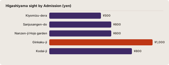
Higashiyama is the temple and old-town belt that climbs the eastern hills from the Kamo River, running roughly from Sanjusangen-do and Kiyomizu-dera in the south past Kodai-ji, Yasaka Shrine and Gion up to Nanzen-ji, Ginkaku-ji and the Philosopher's Path in the north. It is the densest sightseeing zone in the city and the one where most of the classic postcard streets, Ninenzaka, Sannenzaka and the lanes below Kiyomizu, actually sit. The paid temples here range from 500 yen to 1,000 yen, and the zone is walkable end to end in a full day.
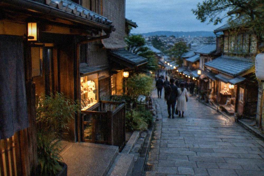
The southern half is the walk most first-timers take. Kiyomizu-dera opens at 6:00 daily, with closing times that vary by season and event, and its admission is 500 yen. Sanjusangen-do, a short walk south, holds the 1,001 Kannon statues the temple itself counts, with general admission at 600 yen and hours of 8:30 to 17:00 from April to mid-November. The slopes between them, Ninenzaka and Sannenzaka, are the preserved machiya streets that appear in nearly every Kyoto photograph, and they hold their crowds from mid-morning onward.
The northern half is quieter and greener. Nanzen-ji keeps hours of 8:40 to 17:00 in the summer half of the year, and its Hojo garden costs 600 yen general admission. Ginkaku-ji, the Silver Pavilion at the top of the Philosopher's Path, doubled its admission on 1 April 2026: the temple's own notice sets adults at 1,000 yen, up from 500, the first change in 32 years. That makes it now twice the 500 yen charged at Kinkaku-ji on the other side of the city, a fact most 2025 guides still get wrong.
Gion sits at the zone's western edge, between the river and the hills, and it behaves differently from the temple streets above it. The Tourism Association's conduct guidelines ask visitors not to touch, chase or photograph geiko and maiko without permission, and on the private alleys off Hanamikoji, signs posted by the local district council threaten a 10,000 yen penalty for unauthorised photography or entry. The main Hanamikoji road itself remains open to cameras.
Gion after dark is a different district from Gion at noon, and it is the one part of the east side where a guide genuinely adds something, since the stories behind the teahouse fronts are invisible to a passer-by. The culture and the streets both reward an evening rather than a midday dash.
| Higashiyama sight | Admission | Hours |
|---|---|---|
| Kiyomizu-dera | 500 yen | Opens 6:00, closing varies by season |
| Sanjusangen-do | 600 yen general | 8:30-17:00 Apr to mid-Nov |
| Nanzen-ji Hojo garden | 600 yen | 8:40-17:00 Mar-Nov |
| Ginkaku-ji | 1,000 yen adult from Apr 2026 | 8:30-17:00 summer season |
| Kodai-ji | 800 yen adult | 9:00-17:30 |
What Makes Arashiyama And Kyoto's Western Edge Different?
Arashiyama is the riverside district on Kyoto's western edge, where the Katsura River leaves the mountains, and it combines the bamboo grove, Tenryu-ji, the Iwatayama Monkey Park and the Sagano Romantic Train in a walkable strip that feels like a separate small town rather than a city district. The bamboo path itself is free and open at all hours, Tenryu-ji's garden is 500 yen, and the monkey park is 800 yen for visitors 16 and over. Most of Arashiyama sits within a 15-minute walk of the JR Saga-Arashiyama and Keifuku Arashiyama stations.
The geography explains the mood. The district backs straight onto forested hills, and the Hozugawa gorge feeds into it from the north, which is why two river operators work here. The Sagano Romantic Train runs a one-way fare of 880 yen adult and 440 yen child, adult meaning 12 and over, along the gorge, and its season runs roughly March to December. The Hozugawa Kudari boat ride costs 6,000 yen adult and 4,500 yen child for about two hours on a 24-seat shared boat, with the regular timetable running 10 March to 13 December 2026. A widely repeated figure of about 4,100 yen for the boat is stale; the operator's own ticket page sets the current price.
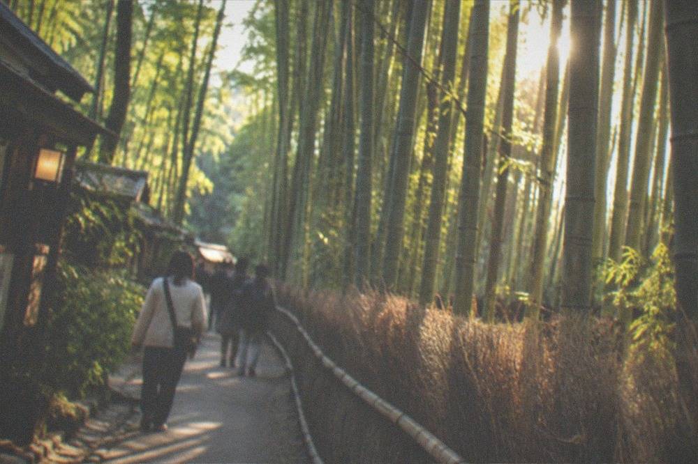
Tenryu-ji, the World Heritage Zen temple facing the grove, tickets its areas separately: the garden at 500 yen, the buildings for 300 yen more, and the Cloud Dragon ceiling of the Hatto for another 500 yen. The monkey park sits across the river and up a hill, open 9:00 to 16:00, cash only, and it closes early in bad weather or when the monkeys retreat up the hill, so the park's own site is worth a check on a grey day. The walking routes through the grove and up to the park are covered in the site's Arashiyama pages.
A guided walk is the efficient way to see the west side, because the district's sights sit along a single line from the grove to the river, and a guide who knows the timing avoids the mid-morning crush at the bamboo path entirely.
Arashiyama rewards an early start more than any other zone, not because of an invented best hour but because of arithmetic: 46.20 million of Kyoto's 2025 visitors were day trippers, and the west side is where many of them head first. The Kyoto crowds guide explains how the city's own comfort forecast, which grades crowding by time slot using location data, can be checked before you set out.
| Arashiyama operator or sight | Price | Notes |
|---|---|---|
| Bamboo grove path | Free | Public path, no gate |
| Tenryu-ji garden | 500 yen | Buildings plus 300 yen, Hatto 500 yen |
| Iwatayama Monkey Park | 800 yen adult, 400 yen ages 4-15 | Cash only, closes in bad weather |
| Sagano Romantic Train | 880 yen adult one way | Season roughly March to December |
| Hozugawa Kudari boat | 6,000 yen adult, 4,500 yen child | About 2 hours, 24 seats |
Where Is Fushimi And What Is Kyoto's Southern District Known For?
Fushimi is the sake-brewing district at Kyoto's southern edge, about ten minutes south of Kyoto Station by JR or Keihan train, and it holds two very different attractions: Fushimi Inari Taisha, the head shrine of about 30,000 Inari shrines nationwide, at the foot of Inariyama, and the canal-side brewery quarter around the Horikawa river a few stops further on. Entry to the shrine is free, the shrine prints no fee anywhere on its site, and the JR Nara Line reaches Inari Station from Kyoto Station in a few minutes for a fare in the low hundreds of yen.
The shrine is the single most-visited place in the city, and the shrine's own pages are the best source on it. Inari Okami was enshrined on Inariyama, which the shrine gives as 233 m, on the first Day of the Horse of the second month of 711, at the order of Empress Genmei and at the hand of Irogu no Hatanokimi, an ancestor of the Hata clan. The shrine hedges its own account with "is said to be", and it counted 2011 as the 1300th anniversary. The mountain holds about 10,000 torii of all sizes across its whole network of paths, not 10,000 in the famous Senbon Torii tunnel, which is the error most competing guides make. The paths have no closing time; the shrine publishes only its desk and prayer hours.
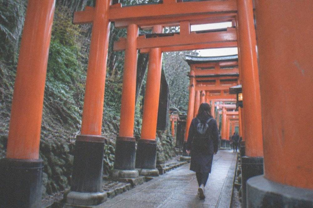
The brewery quarter is the other Fushimi, and it could not feel more different. The Gokogawa canal is lined with wooden brewery fronts belonging to sake makers that still draw the area's soft groundwater, and several offer tours and tastings. The full hiking circuit of the mountain, including the northern loop most day visitors never take, is mapped on the site's Fushimi Inari attraction page.
Because the shrine sits at the far south of the east side and the breweries sit west of the station, Fushimi is best treated as a half-day block on a southward day, or as the first stop of a day that continues to Nara, since the JR Miyakoji Rapid covers Kyoto to Nara in about 45 minutes for 720 yen. The day trips from Kyoto guide picks up that route.
What Is North Kyoto And Who Should Go There?
North Kyoto is the mountain tier that runs from the Kurama and Kibune valleys in the northeast to Ohara and Takao on the western flank, where the city thins into cedar forest, village shrines and hot springs, and it is the zone to trade for a day when temple fatigue sets in. It is the only part of Kyoto that feels alpine, and it holds three of the city's most rewarding half-days: the Kurama to Kibune ridge hike, the riverside village at Kibune, and the moss gardens and onsen baths of Ohara and Takao.
Kurama and Kibune sit at the end of the Eizan railway, a private line that winds up a gorge from Demachiyanagi at the north tip of downtown. Kifune Shrine sits in the village at the bottom of the valley, its approaches lined with lanterns and its stream running directly beneath the dining platforms of the local restaurants in summer. The Kurama and Kibune guide covers the hike between the two villages, and the onsen culture that caps the day, since Kurama's rotenburo is one of the few open-air baths reachable by rail from the centre.
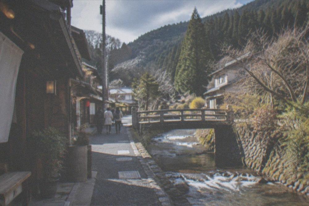
Ohara sits an hour north by bus from the centre, and Takao a similar distance up its own valley, both of them holding temples, Jakko-in at Ohara and Jingo-ji at Takao among them, that sit in forest clearings rather than on city streets. The smaller temples of this tier are listed in the site's hidden-gems coverage, and the mountain paths themselves, including the Kurama ridge, cost nothing to walk.
The north is also the zone where the city's climate data matters most. The JMA 1991-2020 normals for Kyoto station show January with a mean of 4.8 C and a mean daily low of 1.5 C, while August, the hottest month, averages 28.5 C with a mean daily high of 33.7 C. The mountain tier runs a few degrees cooler than the basin in summer and colder in winter, so pack a layer even in the warmer months.
How Many Days Should You Give Each Kyoto Area?
A first visit of three to four days splits naturally into one day for Higashiyama, one for Arashiyama and the north-west, one for Fushimi plus downtown, and a fourth flexible day for the mountain north or a Nara extension. The city's 2025 survey recorded 16.59 million overnight guests, and satisfaction above 90% for both Japanese and foreign visitors, but about half of Japanese visitors still reported something disappointing, most often congestion, which is what an area-per-day plan exists to avoid. Two-day trips should take Higashiyama and Arashiyama and save Fushimi for a later visit.
The reason to plan by area rather than by sight is transport arithmetic. The flat bus fare is 230 yen and the subway runs 220 to 360 yen by zone, but the bus-only one-day pass no longer exists: sales ended in September 2023 and the pass died on 31 March 2024, because the city's transport bureau found 90% of its buyers were non-residents concentrating themselves on the same few routes. The current product is the Subway and Bus One-Day Pass at 1,100 yen, and the tourist express buses EX100 and EX101 charge 500 yen a ride to move visitors from Kyoto Station to the Kiyomizu and Gion side with fewer stops. The Kyoto buses guide explains the network in full.
| Kyoto area | Minimum time | Best base if short on time |
|---|---|---|
| Downtown and Kyoto Station | Half a day plus arrival time | Anywhere on the Karasuma subway line |
| Higashiyama | One full day | Gion or the river east bank |
| Arashiyama | Half to three-quarters of a day | Downtown, 15 minutes by train |
| Fushimi | Half a day | Kyoto Station |
| The mountain north | One day | Downtown, via Demachiyanagi |
The ready-made plans follow the same logic. The two days in Kyoto plan gives the east and west sides their own days, and the first-time visitors guide adds the arrival-day logistics. The full activity index lives on the things to do in Kyoto page.
Gion at night is the one district that changes character completely after dark, and an evening walk there slots neatly after a day spent in any of the other zones, since it starts a few minutes from the downtown core.
How Does Kyoto's Layout Affect Where You Should Stay?
The most efficient place to stay is the downtown belt between Kyoto Station and the Kamo River, because it is the only base from which all five zones are a single train or bus ride away, with Higashiyama across the river on foot, Arashiyama 15 minutes west by rail, and Fushimi 10 minutes south. Staying inside a sightseeing district such as Higashiyama or Arashiyama buys atmosphere but costs connectivity, since the last trains back to those areas end early. The accommodation tax, which changed on 1 March 2026, adds 200 to 10,000 yen per person per night depending on the room rate.
The tax change matters more than most visitors expect. A room priced at 20,000 yen or more per night now carries 1,000 yen per person per night, up from 500, and the top tier, rooms at 100,000 yen and above, went from 1,000 to 10,000 yen. The city's own announcement sets the base as the room-only charge excluding meals and consumption tax, and the Kyoto accommodation tax guide carries the full tier table.
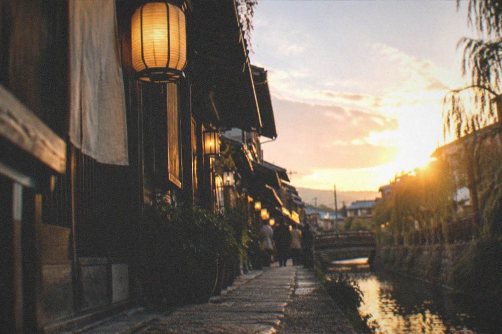
Practical bases by zone: the Kyoto Station area for arrivals, day trips and the Haruka; the downtown Kawaramachi belt for food and nightlife; and the east bank around Gion for a first visit weighted toward Higashiyama. This Kyoto Travel Guide site's full set of area pages exists so you can compare the districts without guesswork. Whichever base you pick, plan by area rather than by checklist: the city recorded 62.79 million visitors in 2025 and the ones who enjoyed it, by the survey's own satisfaction figures, were overwhelmingly the ones who spent each day in one district instead of crossing the basin four times.
Common Questions About Kyoto Neighborhoods
How Is Kyoto Laid Out: Downtown, Higashiyama, Arashiyama, Fushimi, The North?
Kyoto is a basin city with five main zones: the downtown core around Kawaramachi and Kyoto Station, the temple hills of Higashiyama on the east, the riverside west at Arashiyama, the sake district of Fushimi in the south, and the mountain north around Kurama, Kibune, Ohara and Takao. The Kamo River divides downtown from Higashiyama, and the Katsura River anchors the west side.
Which Kyoto Area Should A First-Time Visitor Stay In?
The downtown belt between Kyoto Station and the Kamo River is the most practical base, since every other zone is one train or bus ride from it and Higashiyama is walkable across the river. Gion and the east bank add atmosphere for a Higashiyama-weighted trip, while Arashiyama is better visited than stayed in because late-night transport back is thin.
Can You Walk Between Kyoto's Main Areas?
Downtown and Higashiyama are fully walkable, roughly 20 to 30 minutes from Karasuma to the Kiyomizu slopes, and Gion sits between them. Arashiyama, Fushimi and the mountain north are separate rail or bus trips, about 15 minutes west, 10 minutes south and 30 to 60 minutes north respectively, so plan one area per half-day rather than walking between them.
What Is The Cheapest Way To Move Between Kyoto Neighborhoods?
The flat city bus fare is 230 yen and subway fares run 220 to 360 yen by zone. The bus-only one-day pass no longer exists; the current product is the Subway and Bus One-Day Pass at 1,100 yen adult and 550 yen child, which pays off after three or four rides. The EX100 and EX101 tourist express buses charge 500 yen a ride between Kyoto Station and the Kiyomizu and Gion side.
Is Fushimi Worth Visiting If You Have Already Seen Fushimi Inari?
Yes, because the shrine and the brewery quarter are two different places. The torii paths climb Inariyama at the shrine, while the sake district sits a few stops further on around the Gokogawa canal, lined with working breweries that offer tours and tastings. Entry to the shrine is free, and the two together make a full and varied half-day.
Which Kyoto Area Has The Fewest Crowds?
The mountain north, Kurama, Kibune, Ohara and Takao, carries a fraction of the visitor pressure of the central zones. The city's own comfort forecast, which grades crowding by spot and time slot, is the reliable check for the popular areas, and travelling in the off-peak months helps: January is both the coldest month, averaging 4.8 C, and the driest, with 53.3 mm of rain in the JMA 1991-2020 normals.